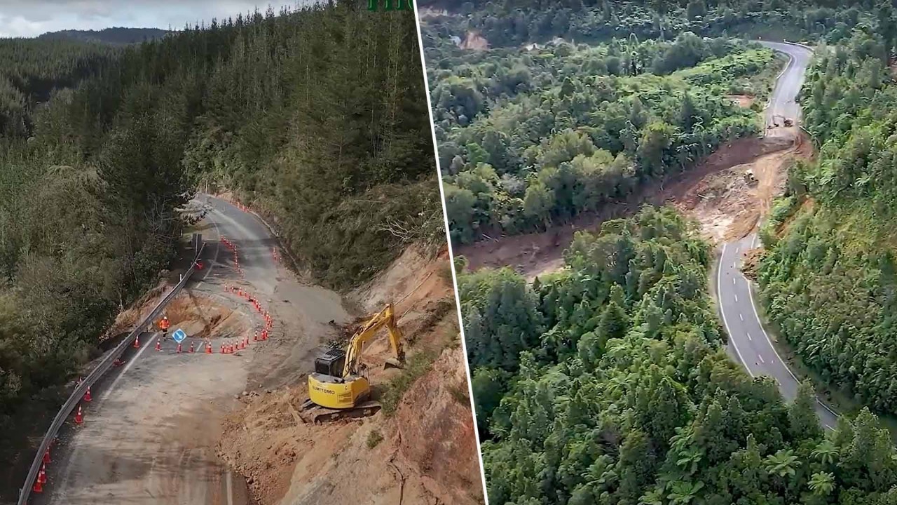

Waka Kotahi has revealed the extent of the slip that has closed State Highway 25a and State Highway 25 in the Coromandel in recently released drone footage.
Footage of both slips captured by the contractors and released by Waka Kotahi shows the extent of the slips and the damage to the roadways.
According to Waka Kotahi, the slip on SH25a is longer than a rugby field and stretches a kilometre downhill.
The agency has established a project team to assess options for rebuilding the highway. Infrastructure Delivery Regional Manager Jo Wilton said the agency is currently testing what the slip is made of and investigating three options to get the road open again.
Waka Kotahi said they are focused on getting this highway open as quickly as possible while prioritising the safety of their crew and the community.
There is no short-term fix for SH25a, and several options are being explored.
A temporary track is being constructed to facilitate the drilling rig's access to the slip site.
Waka Kotahi is also working on other access tracks that will extend above the slip area to reach the potential bypass site. Additionally, another track will be created down to the area of the slip where the potential bridge piles might be located. Further down, another track will lead to the area where a retaining wall could potentially be constructed.
Meanwhile, on the eastern side of the Coromandel Penisula State Highway 25, there will be a majority closure on Friday as work continues on an underslip caused by heavy rain last weekend which caused the slip to grow massively, causing an entire lane to be washed away.
The transport agency has advised motorists to avoid the area and take alternative routes where possible.


SIGN UP TO OUR NEWSLETTER.
Stay in the loop on some of the most important things happening at Today FM - whether it be the biggest news stories, host opinions or the latest on what you need to know about happening on air and on our website. Sign up here.